- About project
- Collections
- Indexes
- Recently viewed
-
RCIN Repositories
-
 INSTYTUT ARCHEOLOGII I ETNOLOGII POLSKIEJ AKADEMII NAUK
-
 INSTYTUT BADAŃ LITERACKICH POLSKIEJ AKADEMII NAUK
-
 INSTYTUT BADAWCZY LEŚNICTWA
-
 INSTYTUT BIOLOGII DOŚWIADCZALNEJ IM. MARCELEGO NENCKIEGO POLSKIEJ AKADEMII NAUK
-
 INSTYTUT BIOLOGII SSAKÓW POLSKIEJ AKADEMII NAUK
-
 INSTYTUT CHEMII FIZYCZNEJ PAN
-
 INSTYTUT CHEMII ORGANICZNEJ PAN
-
 INSTYTUT FILOZOFII I SOCJOLOGII PAN
-
 INSTYTUT GEOGRAFII I PRZESTRZENNEGO ZAGOSPODAROWANIA PAN
-
 INSTYTUT HISTORII im. TADEUSZA MANTEUFFLA POLSKIEJ AKADEMII NAUK
-
 INSTYTUT JĘZYKA POLSKIEGO POLSKIEJ AKADEMII NAUK
-
 INSTYTUT MATEMATYCZNY PAN
-
 INSTYTUT MEDYCYNY DOŚWIADCZALNEJ I KLINICZNEJ IM.MIROSŁAWA MOSSAKOWSKIEGO POLSKIEJ AKADEMII NAUK
-
 INSTYTUT PODSTAWOWYCH PROBLEMÓW TECHNIKI PAN
-
 INSTYTUT SLAWISTYKI PAN
-
 SIEĆ BADAWCZA ŁUKASIEWICZ - INSTYTUT TECHNOLOGII MATERIAŁÓW ELEKTRONICZNYCH
-
 MUZEUM I INSTYTUT ZOOLOGII POLSKIEJ AKADEMII NAUK
-
 INSTYTUT BADAŃ SYSTEMOWYCH PAN
-
 INSTYTUT BOTANIKI IM. WŁADYSŁAWA SZAFERA POLSKIEJ AKADEMII NAUK
-

Object
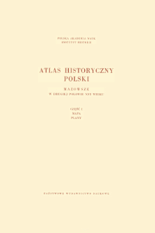
Title: Mazowsze w drugiej połowie XVI wieku ; Cz.1, Mapa, plany
Subtitle:
Contributor:
Pałucki, Władysław (1905–1989) : Red. ; Institute of History of the Polish Academy of Sciences
Publisher:
Place of publishing:
Description:
Title from the cover ; complements the text published in the Atlas historyczny Polski. Polska Akademia Nauk. Instytut Historii. Mapy szczegółowe XVI wieku ; 7 ; contens: the main map in the scale 1:250 000: Mazovia at the end of 16th c. and thematic maps: property in Mazovia at the end of 16th c. ; administrative division of Mazovia at the end of 16th c. ; 1 map and 3 plans: col. jointly folded in cover 36x30 cm ; Scales differ
Relation:
Detailed Resource Type:
Format:
Resource Identifier:
Source:
IH PAN, sygn. III.726/7 cz.1 Podr. ; IH PAN, sygn. III.727/7 cz.1 ; click here to follow the link
Language:
Rights:
Terms of use:
Copyright-protected material. May be used within the limits of statutory user freedoms
Digitizing institution:
Institute of History of the Polish Academy of Sciences
Original in:
Library of the Institute of History PAS
Projects co-financed by:
Programme Innovative Economy, 2010-2014, Priority Axis 2. R&D infrastructure ; European Union. European Regional Development Fund
Access:
Object collections:
- Digital Repository of Scientific Institutes > Partners' collections > Institute of History PAS > Historical atlases
- Digital Repository of Scientific Institutes > Partners' collections > Institute of History PAS > Institute Publications
- Digital Repository of Scientific Institutes > Partners' collections > Institute of History PAS > Institute Publications > Books
- Digital Repository of Scientific Institutes > Literature > Maps/Atlases
Last modified:
Dec 9, 2021
In our library since:
May 30, 2012
Number of object content downloads / hits:
17253
All available object's versions:
https://rcin.org.pl/publication/6814
Show description in RDF format:
Show description in RDFa format:
Show description in OAI-PMH format:
| Edition name | Date |
|---|---|
| Mazowsze w drugiej połowie XVI wieku ; Cz.1, Mapa, plany | Dec 9, 2021 |
Objects Similar
Borek, Arkadiusz Orłowska, Anna Paulina (1983– ) Chłapowski, Krzysztof (1947– ) Dembiński, Paweł Gochna, Michał (1988– ) Kuc-Czerep, Marta Panecki, Tomasz Piber-Zbieranowska, Marta (1974– ) Rutkowska, Elżbieta Słomska, Katarzyna Słomski, Michał (1990– ) Sowina, Urszula (1952– ) Stępniak, Milena Suproniuk, Jarosław Szady, Bogumił (1969– ) Zbieranowski, Michał Związek, Tomasz


