- About project
- Collections
- Indexes
- Recently viewed
-
RCIN Repositories
-
 INSTYTUT ARCHEOLOGII I ETNOLOGII POLSKIEJ AKADEMII NAUK
-
 INSTYTUT BADAŃ LITERACKICH POLSKIEJ AKADEMII NAUK
-
 INSTYTUT BADAWCZY LEŚNICTWA
-
 INSTYTUT BIOLOGII DOŚWIADCZALNEJ IM. MARCELEGO NENCKIEGO POLSKIEJ AKADEMII NAUK
-
 INSTYTUT BIOLOGII SSAKÓW POLSKIEJ AKADEMII NAUK
-
 INSTYTUT CHEMII FIZYCZNEJ PAN
-
 INSTYTUT CHEMII ORGANICZNEJ PAN
-
 INSTYTUT FILOZOFII I SOCJOLOGII PAN
-
 INSTYTUT GEOGRAFII I PRZESTRZENNEGO ZAGOSPODAROWANIA PAN
-
 INSTYTUT HISTORII im. TADEUSZA MANTEUFFLA POLSKIEJ AKADEMII NAUK
-
 INSTYTUT JĘZYKA POLSKIEGO POLSKIEJ AKADEMII NAUK
-
 INSTYTUT MATEMATYCZNY PAN
-
 INSTYTUT MEDYCYNY DOŚWIADCZALNEJ I KLINICZNEJ IM.MIROSŁAWA MOSSAKOWSKIEGO POLSKIEJ AKADEMII NAUK
-
 INSTYTUT PODSTAWOWYCH PROBLEMÓW TECHNIKI PAN
-
 INSTYTUT SLAWISTYKI PAN
-
 SIEĆ BADAWCZA ŁUKASIEWICZ - INSTYTUT TECHNOLOGII MATERIAŁÓW ELEKTRONICZNYCH
-
 MUZEUM I INSTYTUT ZOOLOGII POLSKIEJ AKADEMII NAUK
-
 INSTYTUT BADAŃ SYSTEMOWYCH PAN
-
 INSTYTUT BOTANIKI IM. WŁADYSŁAWA SZAFERA POLSKIEJ AKADEMII NAUK
-

Object
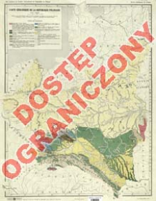
Title: Carte géologique de la République Polonaise
Contributor:
Kuźniar, Czesław (1889–1955) : Oprac. ; Państwowy Instytut Geologiczny ; Instytut Kartograficzny im. Eugeniusza Romera ; Międzynarodowy Kongres Geograficzny (14 ; 1934 ; Warszawa)
Publisher:
Instytut Kartograficzny Atlas imienia E. Romera ; (Imp. Książnica-Atlas)
Place of publishing:
Description:
Skala 1:2 500 000 ; 1 mapa : kolor. ; 44x33 cm, na ark. 50x39 cm ; Na mapie adnot.: Dréssée à l'aide des documents inédits du Service Géologique de Pologne et des documents inédits de St. Pawłowski, E. Romer, B. Świderski, A. Mazurek, St. Małkowski et Br. Halicki et d'autres; Aux membres du Congrés International de Géographie en Pologne; Base de la carte de la Pologne au 2,500.000éme de E. Romer et T. Szumański ; Mapa wyd. dla uczestników Międzynarodowego Kongresu Geograficznego zorganizowanego w Warszawie w 1934 r. Data wyd. związana z datą organizacji Kongresu
Detailed Resource Type:
Format:
Resource Identifier:
Source:
CBGiOŚ. IGiPZ PAN, sygn. D.2350 [m.geol.3] ; CBGiOŚ. IGiPZ PAN, sygn. PTG D.705 [m.geol.2] ; click here to follow the link
Language:
Rights:
Prawa zastrzeżone - dostęp ograniczony
Terms of use:
Digitizing institution:
Instytut Geografii i Przestrzennego Zagospodarowania Polskiej Akademii Nauk
Original in:
Projects co-financed by:
Program Operacyjny Innowacyjna Gospodarka, lata 2010-2014, Priorytet 2. Infrastruktura strefy B + R ; Unia Europejska. Europejski Fundusz Rozwoju Regionalnego
Access:
Object collections:
- Digital Repository of Scientific Institutes > Partners' collections > Institute of Geography and Spatial Organization PAS (IGiPZ PAN) > Library
- Digital Repository of Scientific Institutes > Partners' collections > Institute of Geography and Spatial Organization PAS (IGiPZ PAN) > Library > Maps and atlases
- Digital Repository of Scientific Institutes > Partners' collections > Institute of Geography and Spatial Organization PAS (IGiPZ PAN) > Library > Selected collections > Polish Geographical Society Collection
- Digital Repository of Scientific Institutes > Literature > Maps/Atlases
Last modified:
Oct 2, 2020
In our library since:
Jun 13, 2013
Number of object content downloads / hits:
28
All available object's versions:
https://rcin.org.pl/publication/36556
Show description in RDF format:
Show description in RDFa format:
Show description in OAI-PMH format:
| Edition name | Date |
|---|---|
| Kuźniar, Czesław (1889-1955). Oprac., [1934?], Carte géologique de la République Polonaise | Oct 2, 2020 |
Objects Similar
Grzybowski, Józef (1869–1922) Morozewicz, Józef (1865–1941) Weyberg, Zygmunt (1872–1945)
Tołwiński, Konstanty (1877–1961)


