- About project
- Collections
- Indexes
- Recently viewed
-
RCIN Repositories
-
 INSTYTUT ARCHEOLOGII I ETNOLOGII POLSKIEJ AKADEMII NAUK
-
 INSTYTUT BADAŃ LITERACKICH POLSKIEJ AKADEMII NAUK
-
 INSTYTUT BADAWCZY LEŚNICTWA
-
 INSTYTUT BIOLOGII DOŚWIADCZALNEJ IM. MARCELEGO NENCKIEGO POLSKIEJ AKADEMII NAUK
-
 INSTYTUT BIOLOGII SSAKÓW POLSKIEJ AKADEMII NAUK
-
 INSTYTUT CHEMII FIZYCZNEJ PAN
-
 INSTYTUT CHEMII ORGANICZNEJ PAN
-
 INSTYTUT FILOZOFII I SOCJOLOGII PAN
-
 INSTYTUT GEOGRAFII I PRZESTRZENNEGO ZAGOSPODAROWANIA PAN
-
 INSTYTUT HISTORII im. TADEUSZA MANTEUFFLA POLSKIEJ AKADEMII NAUK
-
 INSTYTUT JĘZYKA POLSKIEGO POLSKIEJ AKADEMII NAUK
-
 INSTYTUT MATEMATYCZNY PAN
-
 INSTYTUT MEDYCYNY DOŚWIADCZALNEJ I KLINICZNEJ IM.MIROSŁAWA MOSSAKOWSKIEGO POLSKIEJ AKADEMII NAUK
-
 INSTYTUT PODSTAWOWYCH PROBLEMÓW TECHNIKI PAN
-
 INSTYTUT SLAWISTYKI PAN
-
 SIEĆ BADAWCZA ŁUKASIEWICZ - INSTYTUT TECHNOLOGII MATERIAŁÓW ELEKTRONICZNYCH
-
 MUZEUM I INSTYTUT ZOOLOGII POLSKIEJ AKADEMII NAUK
-
 INSTYTUT BADAŃ SYSTEMOWYCH PAN
-
 INSTYTUT BOTANIKI IM. WŁADYSŁAWA SZAFERA POLSKIEJ AKADEMII NAUK
-

Object
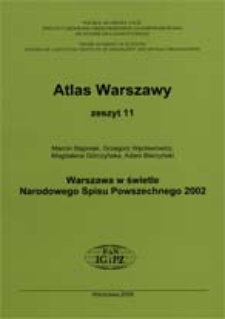
Title: Warszawa w świetle Narodowego Spisu Powszechnego 2002
Creator:
Stępniak, Marcin ; Węcławowicz, Grzegorz ; Góczyńska, Magdalena ; Bierzyński, Adam
Date issued/created:
Resource type:
Subtitle:
Publisher:
Place of publishing:
Description:
Skala 1:75 000 ; Skala 1:175 000 ; 1 atlas ( XL, 114 s.) : diagramy niektóre kolor., mapy niektóre kolor. ; 30 cm ; Atlas zawiera mapy Warszawy w skali 1:175 000, mapy centrum w skali 1:75 000 i 106 kartogramów ; Bibliogr. s. XXIX ; Atlas jest kartograficzną dokumentacją stanu zróżnicowań zjawisk społeczno-przestrzennych i ich zmian na terenie Warszawy ; część tekstowa wyjaśnia i definiuje poszczególne zmienne analityczne przedstawione na kartogramach ; Streszcz. ang.
Type of object:
Relation:
Detailed Resource Type:
Format:
File size 27 MB ; application/pdf
Resource Identifier:
978-83-61590-42-2 ; oai:rcin.org.pl:5180
Source:
CBGiOŚ. IGiPZ PAN, call no. B.3825 [11] ; CBGiOŚ. IGiPZ PAN, call no. B.3826[11] ; CBGiOŚ. IGiPZ PAN, call no. B.4020[11] ; click here to follow the link
Language:
Rights:
Terms of use:
Copyright-protected material. May be used within the limits of statutory user freedoms
Digitizing institution:
Institute of Geography and Spatial Organization of the Polish Academy of Sciences
Original in:
Projects co-financed by:
Programme Innovative Economy, 2010-2014, Priority Axis 2. R&D infrastructure ; European Union. European Regional Development Fund
Access:
Object collections:
- Institute of Geography and Spatial Organization PAS (IGiPZ PAN) > Publications of IGiPZ PAN and employees
- Institute of Geography and Spatial Organization PAS (IGiPZ PAN) > Library > Series/Journals/Periodics
- Institute of Geography and Spatial Organization PAS (IGiPZ PAN) > Library > Maps and atlases
Last modified:
Oct 2, 2020
In our library since:
May 17, 2012
Number of object content downloads / hits:
2580
All available object's versions:
https://rcin.org.pl/igipz/publication/15816
Show description in RDF format:
Show description in RDFa format:
Show description in OAI-PMH format:
| Edition name | Date |
|---|---|
| Z. 11 (2009) : Warszawa w świetle Narodowego Spisu Powszechnego 2002 | Oct 2, 2020 |
Objects Similar
Korcelli-Olejniczak, Ewa Bierzyński, Adam Dworzański, Piotr Grochowski, Mirosław (1957– ) Piotrowski, Filip Węcławowicz, Grzegorz Rijksuniversiteit (Utrecht). Faculteit Geowetenschappen
Węcławowicz, Grzegorz
Węcławowicz, Grzegorz
Stępniak, Marcin
Rosik, Piotr Stępniak, Marcin
Komornicki, Tomasz Stępniak, Marcin
Węcławowicz, Grzegorz Mliczyńska-Hajda, Dagmara


