Object
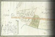
Title: Charte von dem Klodnitz - Canal und denen durchdenselben verlohren gegangenen Grundstücken auf. petersdorffer und Przischoffker Territorio, dem Herrn Baron v Welczek gehörig von Schleuse Nro XVI bis an die Tarnowitzer Strasse
Place of publishing:
Description:
Scale [ca 1:2 510], bar scale: 100 Ruthen Rheinlandisch = [15 cm] ; 1 map : ms., col. ; 29x209 cm ; Date of creation: im July 1806 ; Manuscript map of the Kłodnicki Canal
Detailed Resource Type:
Format:
File size 2,5 MB ; image/x.djvu
Resource Identifier:
Source:
CBGiOŚ. IGiPZ PAN, sign. D.11387 [II.7B-28] ; click here to follow the link
Language:
Rights:
Terms of use:
Digitizing institution:
Institute of Geography and Spatial Organization of the Polish Academy of Sciences
Original in:
Projects co-financed by:
Programme Innovative Economy, 2010-2014, Priority Axis 2. R&D infrastructure ; European Union. European Regional Development Fund
Access:
Object collections:
- Institute of Geography and Spatial Organization PAS (IGiPZ PAN) > Library
- Institute of Geography and Spatial Organization PAS (IGiPZ PAN) > Library > Maps and atlases
Last modified:
Oct 2, 2020
In our library since:
Aug 1, 2012
Number of object content downloads / hits:
537
All available object's versions:
https://rcin.org.pl/igipz/publication/12121
Show description in RDF format:
Show description in RDFa format:
Show description in OAI-PMH format:
Objects Similar
Urbański, Teodor
Reymann, Daniel Gottlob (1759–1837) Oesfeld, Karl Wilhelm von (1781–1843)
Oppermann, Karl Ivanovič (1765–1831) Rosja. Armiâ. Glavnyj Štab. Voenno-Topografičeskij Otdel
Bergenstrol. Red. D'Avignon, Francis Ferdinand (ca 1813 - ?)
Lange, Henry (1821–1893) Ritter, Karl (1779–1859) Verlag Georg Reimer. Wydawca

 INSTYTUT ARCHEOLOGII I ETNOLOGII POLSKIEJ AKADEMII NAUK
 INSTYTUT BADAŃ LITERACKICH POLSKIEJ AKADEMII NAUK
 INSTYTUT BADAWCZY LEŚNICTWA
 INSTYTUT BIOLOGII DOŚWIADCZALNEJ IM. MARCELEGO NENCKIEGO POLSKIEJ AKADEMII NAUK
 INSTYTUT BIOLOGII SSAKÓW POLSKIEJ AKADEMII NAUK
 INSTYTUT CHEMII FIZYCZNEJ PAN
 INSTYTUT CHEMII ORGANICZNEJ PAN
 INSTYTUT FILOZOFII I SOCJOLOGII PAN
 INSTYTUT GEOGRAFII I PRZESTRZENNEGO ZAGOSPODAROWANIA PAN
 INSTYTUT HISTORII im. TADEUSZA MANTEUFFLA POLSKIEJ AKADEMII NAUK
 INSTYTUT JĘZYKA POLSKIEGO POLSKIEJ AKADEMII NAUK
 INSTYTUT MATEMATYCZNY PAN
 INSTYTUT MEDYCYNY DOŚWIADCZALNEJ I KLINICZNEJ IM.MIROSŁAWA MOSSAKOWSKIEGO POLSKIEJ AKADEMII NAUK
 INSTYTUT PODSTAWOWYCH PROBLEMÓW TECHNIKI PAN
 INSTYTUT SLAWISTYKI PAN
 SIEĆ BADAWCZA ŁUKASIEWICZ - INSTYTUT TECHNOLOGII MATERIAŁÓW ELEKTRONICZNYCH
 MUZEUM I INSTYTUT ZOOLOGII POLSKIEJ AKADEMII NAUK
 INSTYTUT BADAŃ SYSTEMOWYCH PAN
 INSTYTUT BOTANIKI IM. WŁADYSŁAWA SZAFERA POLSKIEJ AKADEMII NAUK


