- O repozytorium
- Kolekcje
- Indeksy
- Historia przeglądania
-
Repozytoria RCIN
-
 INSTYTUT ARCHEOLOGII I ETNOLOGII POLSKIEJ AKADEMII NAUK
-
 INSTYTUT BADAŃ LITERACKICH POLSKIEJ AKADEMII NAUK
-
 INSTYTUT BADAWCZY LEŚNICTWA
-
 INSTYTUT BIOLOGII DOŚWIADCZALNEJ IM. MARCELEGO NENCKIEGO POLSKIEJ AKADEMII NAUK
-
 INSTYTUT BIOLOGII SSAKÓW POLSKIEJ AKADEMII NAUK
-
 INSTYTUT CHEMII FIZYCZNEJ PAN
-
 INSTYTUT CHEMII ORGANICZNEJ PAN
-
 INSTYTUT FILOZOFII I SOCJOLOGII PAN
-
 INSTYTUT GEOGRAFII I PRZESTRZENNEGO ZAGOSPODAROWANIA PAN
-
 INSTYTUT HISTORII im. TADEUSZA MANTEUFFLA POLSKIEJ AKADEMII NAUK
-
 INSTYTUT JĘZYKA POLSKIEGO POLSKIEJ AKADEMII NAUK
-
 INSTYTUT MATEMATYCZNY PAN
-
 INSTYTUT MEDYCYNY DOŚWIADCZALNEJ I KLINICZNEJ IM.MIROSŁAWA MOSSAKOWSKIEGO POLSKIEJ AKADEMII NAUK
-
 INSTYTUT PODSTAWOWYCH PROBLEMÓW TECHNIKI PAN
-
 INSTYTUT SLAWISTYKI PAN
-
 SIEĆ BADAWCZA ŁUKASIEWICZ - INSTYTUT TECHNOLOGII MATERIAŁÓW ELEKTRONICZNYCH
-
 MUZEUM I INSTYTUT ZOOLOGII POLSKIEJ AKADEMII NAUK
-
 INSTYTUT BADAŃ SYSTEMOWYCH PAN
-
 INSTYTUT BOTANIKI IM. WŁADYSŁAWA SZAFERA POLSKIEJ AKADEMII NAUK
-

Obiekt
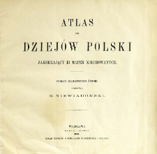
Tytuł: Atlas do dziejów Polski zawierający trzynaście mapek kolorowanych
Wydawca:
Nakład autora ; skład główny w Księgarni Gebethnera i Wolffa
Miejsce wydania:
Opis:
Scales differ ; 1 atlas ([3] p., 13 l.) : lithogr., maps col. ; 31x29 cm ; On maps: Litografia i druk Karola Flemminga w Głogowie
Szczegółowy typ zasobu:
Format:
File size 7,8 MB ; image/x.djvu
Identyfikator zasobu:
Źródło:
CBGiOŚ. IGiPZ PAN, sygn. B.2133 ; kliknij tutaj, żeby przejść
Język:
Prawa:
Zasady wykorzystania:
Digitalizacja:
Institute of Geography and Spatial Organization of the Polish Academy of Sciences
Lokalizacja oryginału:
Dofinansowane ze środków:
Programme Innovative Economy, 2010-2014, Priority Axis 2. R&D infrastructure ; European Union. European Regional Development Fund
Dostęp:
Kolekcje, do których przypisany jest obiekt:
- Instytut Geografii i Przestrzennego Zagospodarowania PAN > Biblioteka Instytutu
- Instytut Geografii i Przestrzennego Zagospodarowania PAN > Biblioteka Instytutu > Mapy i atlasy
Data ostatniej modyfikacji:
2 paź 2020
Data dodania obiektu:
27 sie 2012
Liczba pobrań / odtworzeń:
1350
Wszystkie dostępne wersje tego obiektu:
https://rcin.org.pl/igipz/publication/12659
Wyświetl opis w formacie RDF:
Wyświetl opis w formacie RDFa:
Wyświetl opis w formacie OAI-PMH:
| Nazwa wydania | Data |
|---|---|
| Niewiadomski, Eligiusz (1869-1923). Oprac., 1899, Atlas do dziejów Polski zawierający trzynaście mapek kolorowanych | 2 paź 2020 |
Obiekty Podobne
Wrotnowski, Feliks (1803–1871) Biblioteka Polska (Paryż)
Dufour, Auguste-Henri (1798–1865) Chodźko, Leonard (1800–1871) Flahaut. Ryt. Hacq, J. M. Rys.
Droysen, Gustav (1838–1908) Andree, Richard (1835–1912) Geographische Anstalt von Velhagen und Klasing (Lipsk)
Selves, Henri (17..-18..). Rys.
Houzé, Antoine Université (Paryż ; 1806-1896)
Vidal de La Blache, Paul (1845–1918)
Rhode, C. E. Flemming, Carl (1806–1878)


