- O repozytorium
- Kolekcje
- Indeksy
- Historia przeglądania
-
Repozytoria RCIN
-
 INSTYTUT ARCHEOLOGII I ETNOLOGII POLSKIEJ AKADEMII NAUK
-
 INSTYTUT BADAŃ LITERACKICH POLSKIEJ AKADEMII NAUK
-
 INSTYTUT BADAWCZY LEŚNICTWA
-
 INSTYTUT BIOLOGII DOŚWIADCZALNEJ IM. MARCELEGO NENCKIEGO POLSKIEJ AKADEMII NAUK
-
 INSTYTUT BIOLOGII SSAKÓW POLSKIEJ AKADEMII NAUK
-
 INSTYTUT CHEMII FIZYCZNEJ PAN
-
 INSTYTUT CHEMII ORGANICZNEJ PAN
-
 INSTYTUT FILOZOFII I SOCJOLOGII PAN
-
 INSTYTUT GEOGRAFII I PRZESTRZENNEGO ZAGOSPODAROWANIA PAN
-
 INSTYTUT HISTORII im. TADEUSZA MANTEUFFLA POLSKIEJ AKADEMII NAUK
-
 INSTYTUT JĘZYKA POLSKIEGO POLSKIEJ AKADEMII NAUK
-
 INSTYTUT MATEMATYCZNY PAN
-
 INSTYTUT MEDYCYNY DOŚWIADCZALNEJ I KLINICZNEJ IM.MIROSŁAWA MOSSAKOWSKIEGO POLSKIEJ AKADEMII NAUK
-
 INSTYTUT PODSTAWOWYCH PROBLEMÓW TECHNIKI PAN
-
 INSTYTUT SLAWISTYKI PAN
-
 SIEĆ BADAWCZA ŁUKASIEWICZ - INSTYTUT TECHNOLOGII MATERIAŁÓW ELEKTRONICZNYCH
-
 MUZEUM I INSTYTUT ZOOLOGII POLSKIEJ AKADEMII NAUK
-
 INSTYTUT BADAŃ SYSTEMOWYCH PAN
-
 INSTYTUT BOTANIKI IM. WŁADYSŁAWA SZAFERA POLSKIEJ AKADEMII NAUK
-

Obiekt
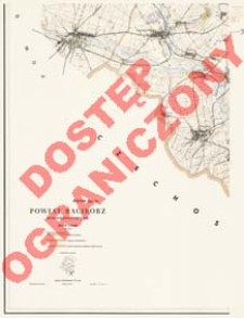
Tytuł: Powiat Racibórz : województwo opolskie : skala 1:25 000
Inny tytuł:
Mapa Obrębowa Powiatów w Skali 1:25 000. Powiat Racibórz
Wydawca:
Zarząd Topograficzny Szt. Gen.
Miejsce wydania:
Opis:
Scale 1:25 000, 1 cm - 250 m ; 1 map on 5 sheets : col. ; each 94x75 cm, complete 175x189 cm ; The processed not-cartometric military map at a scale of 1:25 000 for civil use (Historia Służby Geograficznej i Topograficznej Wojska Polskiego / Eugeniusz Sobczyński. Warszawa, 2000; p. 237) ; Relief shown by contours and spot heights ; No series title on sheets
Czasopismo/Seria/cykl:
Mapa Obrębowa Powiatów w Skali 1:25 000
Szczegółowy typ zasobu:
Format:
Identyfikator zasobu:
Źródło:
CBGiOŚ. IGiPZ PAN, call no. D.15751[1-5] ; kliknij tutaj, żeby przejść
Język:
Prawa:
Rights Reserved - Restricted Access
Zasady wykorzystania:
Digitalizacja:
Institute of Geography and Spatial Organization of the Polish Academy of Sciences
Lokalizacja oryginału:
Dofinansowane ze środków:
Programme Innovative Economy, 2010-2014, Priority Axis 2. R&D infrastructure ; European Union. European Regional Development Fund
Dostęp:
Kolekcje, do których przypisany jest obiekt:
- Instytut Geografii i Przestrzennego Zagospodarowania PAN > Biblioteka Instytutu
- Instytut Geografii i Przestrzennego Zagospodarowania PAN > Biblioteka Instytutu > Mapy i atlasy
Data ostatniej modyfikacji:
2 paź 2020
Data dodania obiektu:
25 lut 2013
Liczba pobrań / odtworzeń:
27
Wszystkie dostępne wersje tego obiektu:
https://rcin.org.pl/igipz/publication/33058
Wyświetl opis w formacie RDF:
Wyświetl opis w formacie RDFa:
Wyświetl opis w formacie OAI-PMH:
| Nazwa wydania | Data |
|---|---|
| Powiat Racibórz : województwo opolskie : skala 1:25 000, 1966 | 2 paź 2020 |
Obiekty Podobne
Kaiserlich-Königliches Militär-Geographisches Institut (Wiedeń). Instytucja sprawcza. Wydawca
Prusy. Landesaufnahme. Kartographische Abteilung. Redaktor
Wieland, Johann Wolfgang (?-1736) Homännische Erben
Związek Radziecki. Vooružennye Sily. Generalʹnyj štab.
Bawaria (Niemcy ; land). Topographisches Bureau. Redaktor Niemcy. Hauptvermessungsabteilung XIII. Wydawca
Wirtembergia (Niemcy). Ministerium des Innern. Hauptvermessungsabteilung XII. Redaktor


