Obiekt
Dostępne formaty:
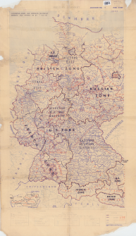
Pobierz wszystkieTytuł: Occupation zones and districts. Germany and Austria as at 1 May 46
Inny tytuł:
Germany and Austria as at 1 May 46
Wydawca:
Miejsce wydania:
Opis:
4th. Edition ; Skala 1:1 000 000 ; 1 mapa : kolorowa ; 102x60 cm, na arkuszu 120x69 cm ; Na dolnym marginesie: Autorities: Obersichtskarte 1/1,000,000 German Map 1942, G.S.G.S, 4042(A) & 4346(A). International Boundaries are as at 1937 oraz 21 A Gp No 67 Adapted from G.S.G.S MISC 149 sheet 1 and 2 ; 4500/APR/46/13 M.R.S./22/2293 ; Mapa podkładowa: Western Germany : administrative boundaries : scale 1:1,000,000 / photolithoģraphed by 13 M.R.S., R.E. 1944. - Third edition ; Mapa poboczna: Austria : Reichgau boundaries : scale 1:4,000,000
Typ obiektu:
Szczegółowy typ zasobu:
Format:
Identyfikator zasobu:
Źródło:
CBGiOŚ. IGiPZ PAN, sygn. D.11776 ; kliknij tutaj, żeby przejść
Język:
Zakres:
Prawa:
Zasady wykorzystania:
Digitalizacja:
Instytut Geografii i Przestrzennego Zagospodarowania Polskiej Akademii Nauk
Lokalizacja oryginału:
Dofinansowane ze środków:
Dostęp:
Kolekcje, do których przypisany jest obiekt:
- Instytut Geografii i Przestrzennego Zagospodarowania PAN > Biblioteka Instytutu
- Instytut Geografii i Przestrzennego Zagospodarowania PAN > Biblioteka Instytutu > Mapy i atlasy
Data ostatniej modyfikacji:
2 cze 2021
Data dodania obiektu:
30 gru 2019
Liczba pobrań / odtworzeń:
107
Wszystkie dostępne wersje tego obiektu:
https://rcin.org.pl/igipz/publication/91054
Wyświetl opis w formacie RDF:
Wyświetl opis w formacie RDFa:
Wyświetl opis w formacie OAI-PMH:
| Nazwa wydania | Data |
|---|---|
| Occupation zones and districts. Germany and Austria as at 1 May 46, 1946 | 2 cze 2021 |
Obiekty Podobne
Verlag des Druckhauses Tempelhof Vorm. Deutscher Verlag Berlin. Drukarz
Wielka Brytania. War Office. Wydawca
Gea Landkarten Verlag. Wydawca Berliner Lithographisches Institut. Drukarz
George Philip and Son. Wydawca Stanford, Edward

 INSTYTUT ARCHEOLOGII I ETNOLOGII POLSKIEJ AKADEMII NAUK
 INSTYTUT BADAŃ LITERACKICH POLSKIEJ AKADEMII NAUK
 INSTYTUT BADAWCZY LEŚNICTWA
 INSTYTUT BIOLOGII DOŚWIADCZALNEJ IM. MARCELEGO NENCKIEGO POLSKIEJ AKADEMII NAUK
 INSTYTUT BIOLOGII SSAKÓW POLSKIEJ AKADEMII NAUK
 INSTYTUT CHEMII FIZYCZNEJ PAN
 INSTYTUT CHEMII ORGANICZNEJ PAN
 INSTYTUT FILOZOFII I SOCJOLOGII PAN
 INSTYTUT GEOGRAFII I PRZESTRZENNEGO ZAGOSPODAROWANIA PAN
 INSTYTUT HISTORII im. TADEUSZA MANTEUFFLA POLSKIEJ AKADEMII NAUK
 INSTYTUT JĘZYKA POLSKIEGO POLSKIEJ AKADEMII NAUK
 INSTYTUT MATEMATYCZNY PAN
 INSTYTUT MEDYCYNY DOŚWIADCZALNEJ I KLINICZNEJ IM.MIROSŁAWA MOSSAKOWSKIEGO POLSKIEJ AKADEMII NAUK
 INSTYTUT PODSTAWOWYCH PROBLEMÓW TECHNIKI PAN
 INSTYTUT SLAWISTYKI PAN
 SIEĆ BADAWCZA ŁUKASIEWICZ - INSTYTUT TECHNOLOGII MATERIAŁÓW ELEKTRONICZNYCH
 MUZEUM I INSTYTUT ZOOLOGII POLSKIEJ AKADEMII NAUK
 INSTYTUT BADAŃ SYSTEMOWYCH PAN
 INSTYTUT BOTANIKI IM. WŁADYSŁAWA SZAFERA POLSKIEJ AKADEMII NAUK


