- About project
- Collections
- Indexes
- Recently viewed
-
RCIN Repositories
-
 INSTYTUT ARCHEOLOGII I ETNOLOGII POLSKIEJ AKADEMII NAUK
-
 INSTYTUT BADAŃ LITERACKICH POLSKIEJ AKADEMII NAUK
-
 INSTYTUT BADAWCZY LEŚNICTWA
-
 INSTYTUT BIOLOGII DOŚWIADCZALNEJ IM. MARCELEGO NENCKIEGO POLSKIEJ AKADEMII NAUK
-
 INSTYTUT BIOLOGII SSAKÓW POLSKIEJ AKADEMII NAUK
-
 INSTYTUT CHEMII FIZYCZNEJ PAN
-
 INSTYTUT CHEMII ORGANICZNEJ PAN
-
 INSTYTUT FILOZOFII I SOCJOLOGII PAN
-
 INSTYTUT GEOGRAFII I PRZESTRZENNEGO ZAGOSPODAROWANIA PAN
-
 INSTYTUT HISTORII im. TADEUSZA MANTEUFFLA POLSKIEJ AKADEMII NAUK
-
 INSTYTUT JĘZYKA POLSKIEGO POLSKIEJ AKADEMII NAUK
-
 INSTYTUT MATEMATYCZNY PAN
-
 INSTYTUT MEDYCYNY DOŚWIADCZALNEJ I KLINICZNEJ IM.MIROSŁAWA MOSSAKOWSKIEGO POLSKIEJ AKADEMII NAUK
-
 INSTYTUT PODSTAWOWYCH PROBLEMÓW TECHNIKI PAN
-
 INSTYTUT SLAWISTYKI PAN
-
 SIEĆ BADAWCZA ŁUKASIEWICZ - INSTYTUT TECHNOLOGII MATERIAŁÓW ELEKTRONICZNYCH
-
 MUZEUM I INSTYTUT ZOOLOGII POLSKIEJ AKADEMII NAUK
-
 INSTYTUT BADAŃ SYSTEMOWYCH PAN
-
 INSTYTUT BOTANIKI IM. WŁADYSŁAWA SZAFERA POLSKIEJ AKADEMII NAUK
-

Object
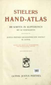
Title: Stielers Hand-Atlas : 100 Karten in Kupferstich mit 162 Nebenkarten
Publisher:
Place of publishing:
Description:
9, von Grund aus neubearbeitete und neugeschtochene Aufl. ; Skale różne ; 1 atlas ([2], 100 k. złoż., [4], 238 s.) : mapy kolor. ; 41 cm ; Zweiter berichtigter Abdruck ; Indeks : Alphabetisches Namenverzeichnis
Detailed Resource Type:
Format:
Resource Identifier:
Source:
CBGiOŚ. IGiPZ PAN, sygn. B.KS.454 ; click here to follow the link
Language:
Rights:
Terms of use:
Digitizing institution:
Instytut Geografii i Przestrzennego Zagospodarowania Polskiej Akademii Nauk
Original in:
Projects co-financed by:
Program Operacyjny Innowacyjna Gospodarka, lata 2010-2014, Priorytet 2. Infrastruktura strefy B + R ; Unia Europejska. Europejski Fundusz Rozwoju Regionalnego
Access:
Object collections:
- Institute of Geography and Spatial Organization PAS (IGiPZ PAN) > Library > Maps and atlases
- Institute of Geography and Spatial Organization PAS (IGiPZ PAN) > Library > Selected collections > Prof. Józef Staszewski Collection
Last modified:
Oct 2, 2020
In our library since:
Apr 15, 2013
Number of object content downloads / hits:
2346
All available object's versions:
https://rcin.org.pl/igipz/publication/23147
Show description in RDF format:
Show description in RDFa format:
Show description in OAI-PMH format:
| Edition name | Date |
|---|---|
| Stieler, Adolf (1775-1836), 1907, Stielers Hand-Atlas : 100 Karten in Kupferstich mit 162 Nebenkarten | Oct 2, 2020 |
Objects Similar
Stieler, Adolf (1775–1836) Habenicht, Hermann (1844–1917) Vogel, Carl (1828–1897) Justus Perthes (Gotha)
Stieler, Adolf (1775–1836) Justus Perthes (Gotha)
Stieler, Adolf (1775–1836) Justus Perthes (Gotha). Instytucja sprawcza Wydawca
Stieler, Adolf (1775–1836) Justus Perthes (Gotha)
Stieler, Adolf (1775–1836)
Stieler, Adolf (1775–1836)
Stieler, Adolf (1775–1836)
Stieler, Adolf (1775–1836) Stülpnagel, Friedrich von (1786–1865)


