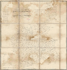
Object
Title: General'naâ karta Carstva Pol'skago = Carte générale du Royaume de Pologne
Date issued/created:
Subtitle:
Carte générale du Royaume d Pologne
Publisher:
Litografirovano pri Departamentě Voennnyh Poselenìj
Place of publishing:
Description:
Scale [ca 1:840 000] ; 1 map on 4 sheets : lithogr. ; each sheet 36x35 cm, total 71x70 cm ; Prime meridian Ferro ; Title, legend of the map in Russian and French, geographical names on the map in Russian and Polish ; Cited in: Mapy 1815-1915 BN. - 1997, poz. 83
Format:
Resource Identifier:
Source:
CBGiOŚ. IGiPZ PAN, call no. Ds.8873 [I.9A-9]
Language:
Rights:
Terms of use:
Digitizing institution:
Institute of Geography and Spatial Organization of the Polish Academy of Sciences
Original in:
Projects co-financed by:
European Union. European Regional Development Fund ; Programme Innovative Economy, 2010-2014, Priority Axis 2. R&D infrastructure
Access:
Object collections:
- Digital Repository of Scientific Institutes > Partners' collections > Institute of Geography and Spatial Organization PAS (IGiPZ PAN) > Library > Maps and atlases
- Digital Repository of Scientific Institutes > Literature > Maps/Atlases
Last modified:
Sep 6, 2019
In our library since:
Aug 20, 2009
Number of object content downloads / hits:
24 880
All available object's versions:
https://rcin.org.pl/publication/204
Show description in RDF format:
Show description in RDFa format:
Show description in OAI-PMH format:
| Edition name | Date |
|---|---|
| General'naja Karta Carstva Pol'skago = Carte Generale du Royaume de Pologne | Sep 6, 2019 |
Objects Similar
Samborska-Kukuć, Dorota Jaros, Maja Giebułtowski, Jerzy
Gotz, Marceli
Gotz, Marceli
Kośmiński, Józef (ca 1797-18..). Wyd. Sławiński, Józef. Litogr.
Kasprzykiewicz, Feliks Julian (1840-1915). Litogr.

 INSTYTUT ARCHEOLOGII I ETNOLOGII POLSKIEJ AKADEMII NAUK
 INSTYTUT BADAŃ LITERACKICH POLSKIEJ AKADEMII NAUK
 INSTYTUT BADAWCZY LEŚNICTWA
 INSTYTUT BIOLOGII DOŚWIADCZALNEJ IM. MARCELEGO NENCKIEGO POLSKIEJ AKADEMII NAUK
 INSTYTUT BIOLOGII SSAKÓW POLSKIEJ AKADEMII NAUK
 INSTYTUT CHEMII FIZYCZNEJ PAN
 INSTYTUT CHEMII ORGANICZNEJ PAN
 INSTYTUT FILOZOFII I SOCJOLOGII PAN
 INSTYTUT GEOGRAFII I PRZESTRZENNEGO ZAGOSPODAROWANIA PAN
 INSTYTUT HISTORII im. TADEUSZA MANTEUFFLA POLSKIEJ AKADEMII NAUK
 INSTYTUT JĘZYKA POLSKIEGO POLSKIEJ AKADEMII NAUK
 INSTYTUT MATEMATYCZNY PAN
 INSTYTUT MEDYCYNY DOŚWIADCZALNEJ I KLINICZNEJ IM.MIROSŁAWA MOSSAKOWSKIEGO POLSKIEJ AKADEMII NAUK
 INSTYTUT PODSTAWOWYCH PROBLEMÓW TECHNIKI PAN
 INSTYTUT SLAWISTYKI PAN
 SIEĆ BADAWCZA ŁUKASIEWICZ - INSTYTUT TECHNOLOGII MATERIAŁÓW ELEKTRONICZNYCH
 MUZEUM I INSTYTUT ZOOLOGII POLSKIEJ AKADEMII NAUK
 INSTYTUT BADAŃ SYSTEMOWYCH PAN
 INSTYTUT BOTANIKI IM. WŁADYSŁAWA SZAFERA POLSKIEJ AKADEMII NAUK


