Object
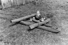
Agricultural tools
Typ zasobu:
Nazwa:
Inne nazwy:
Typ obiektu:
Lokalizacja-położenie administracyjne(współczesne):
Kozietuły, Mogielnica commune, Grójec district, mazowieckie voivodeship
Lokalizacja- położenie administracyjne (dawne):
Kozietuły, Grójec district, Warsaw voivodeship
Lokalizacja- położenie topograficzne:
Zobacz na mapie:
Opis obiektu:
Autor (rysunku, zdjęcia, rekordu):
Data badań:
Numer inwentarzowy:
Uwagi:
Photo negative No F 481/62/6/P 43 (22-37)
Czasopismo/Seria/cykl:
Szczegółowy typ zasobu:
Identyfikator zasobu:
Prawa:
Zasady wykorzystania:
Digitalizacja:
Institute of Archaeology and Ethnology of the Polish Academy of Sciences
Lokalizacja oryginału:
Institute of Archaeology and Ethnology of the Polish Academy of Sciences
Dofinansowane ze środków:
Operational Program Digital Poland, 2014-2020, Measure 2.3: Digital accessibility and usefulness of public sector information; funds from the European Regional Development Fund and national co-financing from the state budget. ; European Union. European Regional Development Fund
Dostęp:
Object collections:
- Repozytorium Cyfrowe Instytutów Naukowych > Kolekcje Partnerów > Instytut Archeologii i Etnologii PAN > Materiały etnograficzne > Polski Atlas Etnograficzny
- Repozytorium Cyfrowe Instytutów Naukowych > Dane i obiekty naukowe > Nauki humanistyczne i społeczne > Kolekcje z zakresu antropologii kultury
Last modified:
27 paź 2022
In our library since:
28 paź 2021
Number of object content downloads / hits:
25
All available object's versions:
https://rcin.org.pl/publication/265822
Show description in RDF format:
Show description in RDFa format:
Show description in OAI-PMH format:
| Edition name | Date |
|---|---|
| Włóka | 27 paź 2022 |

 INSTYTUT ARCHEOLOGII I ETNOLOGII POLSKIEJ AKADEMII NAUK
 INSTYTUT BADAŃ LITERACKICH POLSKIEJ AKADEMII NAUK
 INSTYTUT BADAWCZY LEŚNICTWA
 INSTYTUT BIOLOGII DOŚWIADCZALNEJ IM. MARCELEGO NENCKIEGO POLSKIEJ AKADEMII NAUK
 INSTYTUT BIOLOGII SSAKÓW POLSKIEJ AKADEMII NAUK
 INSTYTUT CHEMII FIZYCZNEJ PAN
 INSTYTUT CHEMII ORGANICZNEJ PAN
 INSTYTUT FILOZOFII I SOCJOLOGII PAN
 INSTYTUT GEOGRAFII I PRZESTRZENNEGO ZAGOSPODAROWANIA PAN
 INSTYTUT HISTORII im. TADEUSZA MANTEUFFLA POLSKIEJ AKADEMII NAUK
 INSTYTUT JĘZYKA POLSKIEGO POLSKIEJ AKADEMII NAUK
 INSTYTUT MATEMATYCZNY PAN
 INSTYTUT MEDYCYNY DOŚWIADCZALNEJ I KLINICZNEJ IM.MIROSŁAWA MOSSAKOWSKIEGO POLSKIEJ AKADEMII NAUK
 INSTYTUT PODSTAWOWYCH PROBLEMÓW TECHNIKI PAN
 INSTYTUT SLAWISTYKI PAN
 SIEĆ BADAWCZA ŁUKASIEWICZ - INSTYTUT TECHNOLOGII MATERIAŁÓW ELEKTRONICZNYCH
 MUZEUM I INSTYTUT ZOOLOGII POLSKIEJ AKADEMII NAUK
 INSTYTUT BADAŃ SYSTEMOWYCH PAN
 INSTYTUT BOTANIKI IM. WŁADYSŁAWA SZAFERA POLSKIEJ AKADEMII NAUK


